Friday, 12 October 2012

York

The train ride to York went by quickly and comfortably. I found my accommodation easily in the town centre. The Fort Boutique Hostel was a basic set up, but very comfortable and centrally located. Quiet too.
After settling in, I took a small walk around the town to stretch my legs, had dinner and had a read before calling it an early night.
The next morning, I started my sightseeing with the York Minster. I walked around the outside of it. There was a section enclosed where they were carving the limestone for restoration. It's always under restoration due to the type of stone. Limestone just doesn't seen to erode slowly.
It was neat to see the stone worker's and how they duplicate all the original decorative designs and shapes.
The entry fee was a bit too steep so me right then, so I put it on my to do list and just marvelled at the  Gothic architecture of the church itself. I really liked the grotesques and gargoyles. Many had their tongues sticking out. Made for lighthearted humour as was more common at the end of the Gothic Architectural period.
Then I walked the medieval streets in the city centre and looked at all the shops. I loved the look and feel of the old part of town. The cobbled streets with narrow alleys (called snickelways), old lamp posts, quaint little speciality shops, little eateries and tons of tourist entertainment. One of my favourite stores was the Vom Fass. It sold oils, vinegars, spirits, liqueurs and wines. I was able to sample pretty much everything. The amazing variety of oils and vinegar combination you can do there is to die for. Hmmm, pistachio oil... and the mango raspberry balsamic vinegar. Yum. I also tried his Blood orange with vodka cocktail, that was nice. So many nice things he made. If I ever lived here, I'd be a frequent customer!
I window shopped at the Chocolate York Sweet Story, but decided against the tour as I plan to do that in Europe where the amazing chocolate is made. Am I hoping for some trade secrets for their exquisite chocolate... maaaayyybeee. He he.
Another nice thing about this part of town is that there is minimal traffic. Hardly any cars drive through this part of town, making it easy to walk anywhere, day or night.
I really liked walking down the Shambles street. This is a very old street, dating back to the 14th century, and many of the timber framed buildings don't have their foundations anymore and lean at different angles. This is also where the butchers sold their meat. It once had 25 butcher shops, but now there are none. You can see the hooks still in the stone facades of the building where they hung meat up, and where the shelves were to display. In those days, they would have had a runnel in the cobbled street for the blood to drain away.
I can see why this street is popular for the ghost tours. In which there were many. Tons of ghost walking tours to choose from, as well as haunted houses. If I could afford to do it all, I would. But as it is, I chose to attend the Ghost Trail of York, one of the walking tours starting at the York Minister. With a fee of 4 pounds, I could afford it.
The evening had a perfect start. At 7:30 pm, it was already dark, the air was cool and a misty light haze of fog descended on the city. Couldn't have been a better atmosphere for a ghost walk. Our guide dressed in fashionable garb of top hat and tails, black trousers and a black umbrella.
We saw the Treasurer's house, St. William's College, Holy Trinity church, Mad Alice Lane (a snickelway named after a woman was hanged for poisoning her husband), King's Square, the Shambles, and ended in Newgate Market. He had many historical facts and funny jokes amongst the ghost stories. Wasn't very scary. Though entertaining, especially at a good backpacker price.
The tale I thought was the scariest was a story of the children of Bedern. A man running an orphanage/workhouse took in strayed children and waifs and put them to work. He paid little on food or clothing for them, keeping his earnings more for himself. Many of the children died of starvation and exposure. Soon, too many of them perished and instead of burying the bodies, he'd be lazy and stash them away, such as in a large cupboard to rot. As months passed and bodies piled up, and he thought he could hear screams from the locked cupboard. It drove him mad and one night, he took a knife and massacred the remaining children. He was found the next morning by the authorities, mumbling to himself amongst the deceased, and he spent the rest of his days in an insane asylum. The area is now known for this tale and people claim to hear children laughing or screaming in the Bedern area and feel icy finger touches. A sad story, but a favourite to be told none the less.
He also pointed out a few black cats along the streets. Not real ones... but statuettes and decorations. No one knows why they're there. One even dates back to the 19th century. But, it's fun to try to find them all, placed around the city. It's now an activity for tourists, especially with children... go on the cat hunt in York. There are 22 known cats around the city, but they say there could be more. Some of the newer ones were made by a local architect named Tom Adams who was obsessed with cats. Interesting. Something to do anyways while strolling the streets.
I loved taking photos of the snickelways and the Shambles street buildings. The crooked, leaning buildings made a neat frame for night photography. Just wished I new more about it. I need to learn more about night photography. On my to do list.
After the tour, I walked around taking some photos before heading to bed.
In the morning, I took a free walking tour by the Exhibition square just by the wall of the city. The volunteer guide knew a lot about the history of the city. It was a lot to take in. We saw the King's Manor (headquarters for Henry the VIII's North council), ruins of St. Mary's abbey, the 4th century Roman fortifications, the architecture of the Yorkshire museum, one of the medieval gateways (Bootham Bar) to the city and wall, St. William's College, went into the old 15th century Holy Trinity Church and sat in the boxed pews and finally the Shambles. Nice to see some of the sights I saw on the night tour in daylight.
I thought the fortifications of the Romans were cool. The Multangular Tower was fairly intact, and 1 of 8 that remains. Seeing the layering of the construction of the walls had a story all in itself. Different eras, different rulers, different construction. The Romans started out the walls back in 71 AD. Then, in 8oo's the Danes (the Danish) in rule restored the walls. Then, restored again in the 12th-14th century in medieval times and again in the 19th century. Very neat.
Since I was on a history kick, I decided to check out the viking settlement, Jorvik. York had about 9 metres of archaeological layers in the soil, and most dating to the viking age. The moist, oxygen free  peaty soil helped preserve any organic remains of textiles like clothing and leather, and timber. Items that usually deteriorate to dust over time from rot. The peat also preserved animal bones, insects, plants, seeds, pollen and human parasitic eggs. All ways to identify diet, health, climate and the environment around the vikings during that era.
This attraction had not only viking artifacts and history, but smells back in their day to really get a feel for their way of life.
Unfortunately, the original smell of a viking in the first exhibit room was too strong for me and I was extremely nauseous. I had to rush through it. Which was a shame because the glass floor covered the excavation site of 3 viking properties with  household items found with them. The glass showed one property and part of the fence that divided the areas by horizontally weaved wattlework between vertical stakes. This being a popular way in the 10th century of boundary establishment.
Amongst the items found were coins, combs made of antler or bone, leather scabbards, amber (fossilized wood resin used for jewelry), knives, brooches used to fasten clothing, and timber.
From there, I took the little cart ride (known as the time cars, taking me back to AD 975) through the next exhibit of the village. They had wax figures to demonstrate the people working in various areas of the village. The smith with his smokey smelling furnace, home-cooked stew at an amber worker's place, passed a man on the toilet (in which they also added the smell here, yuck!), saw into domestic homes and yards, a bone/antler carver, a leather worker, a wood turner, butcher and the market place. They had sound effects and can hear the vikings talk to visitors in Old Norse. The reconstruction was all based on their excavation findings and was well done. I enjoyed that part of the tour. It allowed very good insight to the daily life of the vikings.
Next was an exhibit on what the vikings may have looked like via facial reconstruction, how they lived and any diseases or afflictions they might have endured from the revelations of their skeletons. Also, what their diet was from residue in pottery and everyone's favourite... the encased coprolite. What is that you say? Why, coprolite is fossilized faeces. Nice eh?
The last room displayed weapons used in battle and skeletal remains showing the woulds inflicted from them. Brutal battles back then, that's for sure.
All and all, it was a neat exhibit. Just wished the first room didn't make me want to hurl so much with that smell. Oh well.
After that, I had a bite to eat and checked out some shops on my way to the Bar wall. I entered by the Bootham bar and walked along the walled city. The view was really nice. Quite a pleasant walk. The Monk Bar was neat, as it's portcullis was still in working order.
Then I did more window shopping before calling it a day.
The next morning, I took a train to Scarborough to visit my cousin Margo.
While in Inverness, I had found a lovely Scottish thistle bookmark cross-stitch kit. I worked on that while on the train. A perfect way to pass the time on transport. Starting up a new hobby.

However, easier said than done. I was reading the instructions, and for you that don't know me too well, I've never sewn before. I have trouble sewing on buttons on a shirt! And that's basic stuff. So, needless to say, I was having a bit of trouble getting it right. My stitches were messy and too thin.
Lucky for me, my cousin (3rd cousin, she was cousin to my grandma) does cross-stitching and embroidery, so who better to teach me?
We had a warm reunion when I arrived. She was very happy to see one of her Canadian family members since the distance prevents regular visits. 
She was unable to speak as she had lost that ability from her stroke. But, we were able to communicate well enough. She always had a paper and pen handy.
Catching up was great, she had big smiles when updating her on the family and my travels. And she was more than happy to teach me how to cross-stitch. I finally got it! New hobby here I come!
After staying the night and part of the next day with her, I reluctantly headed back to York.
I had left my belongings with the hostel so I was able to retrieve them and stay a final night there before heading south. 
I looked at Clifford's Tower and walked along the River Ouse admiring the Yorkboats to pass the remainder of the day.
Now, I'm waiting for my bus to take me to Birmingham where I'll then take the train to Stratford-upon-Avon to visit more of my cousins. I'm excited to see more family!


Sunday, 7 October 2012

Fife

After a cool night, I got up to admire the view over Loch Tay. And noticed the mount across the Loch had a dusting of snow. No wonder it was so cool that night.
The drive along the loch was stunning. I really can't get enough of the rolling green hills, woodland and lakes.
I drove to Killin where I checked out the small cascading waterfalls of the Falls of Dochart and scenery of the hills surrounding the village. Then I made my way to Strathyre to go on my last hike.
Strathyre was a small village, so finding the starting point for the Beinn an t-Sidhein trail was easy. It turned out to be the steepest hike I'd done too. May not have been the tallest or longest, but once out of the forest and heading up, it was extremely steep. Ha, probably didn't help that I lost the trail. There was a fork in the trail, one with a coloured marker (other than the trail I was following) and one with no marker. So, I assumed the uncoloured marker was the one I was currently on... it was just missing. Ended up walking a sheep trail through mud and bog. Thank goodness my boots are gortex and still waterproof.
The path sort of just went up... and disappeared and reappeared here and there. So I headed up, scrambling up the slippery side of the hill, even up a creek. Once at the summit, I found the trail I should have been on... much more laid out and less slippery. Ha ha, well it was a challenge at least.

With the wind blowing the rainy clouds in and the sun working it's hardest to shine, another rainbow decorated the landscape. Almost seems like a daily occurrence in Scotland. Just beautiful.
Time to start the drive to Fife. I took the main road to Perth, headed over the Bridge of Earn and took a small side road following along the Firth of Tay inlet to Tayport. I checked out the wooded area there for possible camping, but payment was required to park at the forest. And with lots of private farmland around, there wasn't really anywhere to wildcamp. Wouldn't be easy from here to find any more wildcamping now that I was in more populated areas.
I drove through St. Andrews, which was very busy, and Kingsbarns until Crail. It was already dark and hard to find somewhere to crash for the night. I found a sign for a campsite, but it was closed. A nice lady saw me standing at the gate (debating whether I should just go in anyway and check in at the office in the morning) and offered a cup of tea with her and her husband in their RV. Figured I could ask them for any other camping suggestions.  Turns out the couple were volunteering in the celebrity golf tournament in Kingsbarns. That explained why the area was so busy. They were really funny and I ended up staying 1.5 hours with them. They did suggest  a place I could probably camp near the beach and the Fife coastal path (which stretched the coastline from north to south 117 miles). After a heart felt goodnight, I took off and found a gravel parking area amongst trees and dunes for the beach access in Fife Ness, completely deserted and just slept in the car since I was tired enough to just pass out.

The next morning I had a little looky-loo of the fishing village and then drove to Elie. Another little fishing village. I walked to the Lady Tower. More of a rocky beach and some interesting sandstones constructing the tower itself. Then strolled along the beach in the harbour to the fisherman's wharf and a bit of the town. The tide was out revealing lots of golden sand in the sunshine. It really was a beautiful day. 


I then made my way to Kinghorn and checked into Pettycur Bay Holiday Park campsite. It was pricey, but there weren't really any other camping options. After pitching my tent, I walked on the mixture of black and golden sand on the beach nearby and watched the sunset.
In the morning I drove back to Edinburgh to drop off the car. As soon as I got over the Forth Road Bridge and passed the exit for Queensferry, there was construction on the motorway causing huge traffic delays and traffic jams as people had to go the same route for diversions. I ended up being late. But luckily, I called them and one of the staff members said he'd wait for me. Once I returned the car, he even offered to give me a ride to the city centre so I could check into my hostel. What a nice guy. Great service! Good on ya Enterprise!
I checked into the Caledonia hostel again and spent the rest of the day roaming a bit.
And finally, to conclude my time in Scotland, I was able to meet up for a drink with my camping and drinking pal, John. I was able to keep in touch with both John and Sinclair, whom I met near the beginning of my trip in Glen Etive and it was a perfect way to end my month time up here. Shame Sinclair couldn't make it, but I was sure we'd meet up again. I enjoyed it so much in Scotland that I knew I'd come up again before I left the UK.
And now, I'm heading off to York!

Wednesday, 3 October 2012

Cairngorms National Park

Aviemore was a small village, but I couldn’t believe how many outdoor shops there were. I guess it pays to have competition in the national parks. I decided on staying at the Rothiemurchus caravan and camping park in Coylumbridge. It was a nice place to pitch a tent. I selected a pitch close enough to the stream to hear it, but under the trees. I had lots of space to myself. Quite happy with this campsite. The facilities were well kept as well. Always a bonus.
Once I was all set up, I drove up to the base of Cairngorm mountain, parked the car and chose which  path to hike up. I decided on Windy Ridge path. And I tell you, it was justly named! The wind hiking up along here was really strong! I felt like I was going to blow over through most of hike. It was an interesting 1.5 hour hike to the Ptarmigan building. This building is where the funicular ride ends from the base station. There was a cafe up here, so I popped in for 10 mins to warm up a bit. That wind was very cold, and of course the rain came and went so a quick thaw was just what I needed.
From there, it was just another 20 mins to get to the summit of the mountain. Cairn Gorm summit is 1245 m, but seeing how I had to drive to the car park, I felt like I only walked half that.
What view I could see was very nice. Many mountain tops and overlooking the lochs were gorgeous. Low clouds and fog passed through frequently, taking away visibility both in the distance and around me. I descended towards the gully, following a well worn trail that could be seen through the fog. Mind you, I moved slowly so that when the clouds broke I could get a sense of where the trail headed so not to venture in the wrong direction. Of course, would be difficult for me to do so as I was going downhill. Anywhere else in the gully would go up if I lost my path. So, I wasn’t too worried.
I followed the Coire Cas Mountain Trail back down to base. After a quick gander in the gift shop, I drove to Loch Morlich. There was a lovely 3.5 mile trail going around the loch, passing through Glenmore Forest Park. My starting point lead across a lovely golden beach that eventually became engulfed by tall Caledonian pinewood. This native tree specie once covered most of Scotland and is now carefully managed. Following along the trail were beautiful multi-coloured bracken and purple heather. Other flowers were seen as well. And with that strong wind blowing the clouds around, more rainbows came and went. It was lovely. No one out on the lake doing any water sports though. The wind would have been good for sailing.The next morning I decided to spend the day on another hike. The Loch an Eilein & Inverdruie trail. It was 8.5 miles long. I parked near the Rothiemurchus visitor centre and started the first section towards Lochan Mor. The woodland trail consisted of more ancient native pine, spruce, juniper, common lime, yew and birch trees. Lots of heather, flowers and bracken. Can also see the some hills that form part of the Monadhliath range.

Once at Lochan Mor (also known as Lily loch due to all the waterlilies) I took the path link to the Loch an Eilein.
An interesting fact about these little lochs is that people once built dams, blocking up the loch to cause them to flood the lands. Once flooded, they'd transport logs on the River Spey downstream. That's how Lochan Mor was formed. By artificial floods.
Once at the lake I could see castle ruins on a tiny island. It's over 600 years old. But the old stronghold is more of a place for the birds to nest now. Many native red squirrels around as well. They were chirping and scurrying around across the trail to get to other trees. Dropping pine cones here and there. Cute little guys. Very much like the ones in Canada.
Once at the south point of the loch, I took a small little bush path to walk a loop around Loch Gamhna. I was ahead of the clouds and was walking at a good pace, so figured I had plenty of time to add an extra bit to my walk.
The tiny loch was very nice. Lots of tall grass and cattails along the shoreline. The woodland opened up more as well so there was more light and a view of some hills. I was careful to stick near the rough water path as hunters were in the area looking for deer. Didn't want to accidentally draw their attention.
Then I continued along the main trail, this part known as Thieves road. Centuries ago, cattle raiders used this path for an access to Strathspey. Locals used to tie a couple cows to the trees along Loch Gamhna (why it's also known as Loch of the Stirks, meaning young cattle) to hopefully spare their main herd.
I then continued out into the open heathland enjoying the hill range as I made my way past the occasional cottages to Whitewell, then Upper Tullochgrue and Blackpark where a small cattle farm of Highland cows were. It was sweet watching a mother cow groom her calf. From there I walked to Inverdruie to my car and headed back to camp.
This morning, I took the secondary road through the small towns past Kingussie to the Highland Folk Museum in Newtonmore.
There was an introductory presentation at the at the main building and then you could walk though an old township from the 1700's. The school and a small farm house were from 1930's but the rest was older.
Volunteers were dressed in traditional wear and gave you information of the daily routines and pastimes of the villagers.
The stone houses had thatched roofs. The inside filled with beds, kitchen tables, china wood stove fireplaces and wooden spindles for wool.
There was a an old sheep fank and shepherd's bothy. A place were the farmers had multi-purpose areas for lambing, dipping, shearing, etc. They could separate individual sheep or make a production line so to speak. Pretty useful. To construct it, they layered rocks to make strong walls. Must have taken a long time to build.
The Drystone dykes as well. There were various designs displayed. These hand made stone walls kept there stability by the tight construction and correct placement of stones. Some styles, like the Isle of Skye had a rock pointing up at the top, called a cope layer. Another had turf on the cope layer, allowing the roots to knit the walls together.
Next I came to an old post office which they now sell candy in for the tourists and children. After was the farmhouse. Many old tractors from 1930's and ploughing devices. Also typical horse gear for farming, crop tools and butchering tools.
The village had a watchmakers, tailor, church, school and a joiner (a person who makes wooden components to buildings like stairs or doors). From there, I walked through a wooded area that had a camping pitch example of the old Scotsman. A pond as well where curling was once played, but now a home to ducks. Also learned that curling was invented here in Scotland.
Passed a waterwheel and eventually, I came to more old traditional homes that had heather used for roof thatch. Not many people have the skills to thatch houses anymore, especially knowing how to do it with heather. It was really neat to see. A few woman were there to invite us inside the houses were a fire burned in a pit inside. It was really smoky. Don't know how people tolerated it back then. But, I suppose they get used to it. Either that or freeze!
Bedding and brooms were also made of heather. The woman made thread with their spindles and wool. Also, were some animals for the farm. Chickens and sheep. A rotating rock grinder was outside the houses in a shelter for the grains. It was very interesting to learn how the highlanders lived, dressed, built their homes and tilled the soil.
After my visit, I headed to Ballinluig (passing some really cute cottages!) where I then took a secondary road towards Killin. Now that I've reached the end of my driving stamina, I'm camping outside of Ardtalnaig at a nice logging spot overlooking Loch Tay. Full moon tonight and it's a big one. I don't even need my flashlight! So peaceful here, it will be a good night sleep.

Monday, 1 October 2012

Inverness

I drove into the city centre in Inverness. After parking the car, I had a wander. Walked over the bridge, admiring Inverness castle while doing so. After getting a local map from the information centre, I popped into a market to look at the shop stands. I found a neat embroidery shop. Now, I've never been one for sewing, but they had all kinds of animal designs in the windows and I had to look. I fell in love with the designs. Thought, how hard could it be? Doing cross-stitching or embroidery? After looking at many patterns, I chose a smaller one. A bookmark kit of the Scottish thistle. Perfect! A new hobby to look forward to.
After walking up and down the streets, I decided to watch a film at the cinema. The Disney film, Brave, propaganda was everywhere and figured that if I was going to watch it, it should be seen here in Scotland. Plus, it would be a nice change of pace.
The cinema was just outside of town where all the outlet stores where. It was a great film... however, I do love my cartoons.
After grabbing some lunch, I drove along Loch Ness to Drumnadrochit. It was a small village with a few tourist attractions like The Loch Ness Centre & Exhibition. I decided to go through this Nessie Centre as it had a more scientific approach to the myth.
Starting with the birth of the Loch Ness from the ice age, to environmental fingerprints (by man and nature) in and around the loch, modern day history, explorations and phenomena's that surround it. Lasers and special effects are used creating attractive displays.
Original research equipment, an underwater suit worn for an underwater walk in the loch, sonar survey vessels and submarines, original film footage and photographs were all a part of the exhibition. I learned about hoaxes and optical illusions to truths and findings of the navigation of the loch.
One of the film footages I liked was of a sonar tracking of the Loch Ness. Numerous boats all out within certain distances of one another, leaving no space unscanned, searching and documenting the underwater floor. I large image appeared on one of the sonar screens on the boat and soon disappeared. When they back tracked to find it again, they couldn't. If it was driftwood, or rocks, anything inanimate, they should have had no trouble relocating it. But they never could find it again. Question as to it being a large school of fish was pondered. But thought that the image was too large to be so. More mystery!
It was interesting seeing how folklore and science could come together, still leaving you wondering... is the monster real? Could it have been possible for a creature to survive with all the food and space available in that huge abyss? Even with science, there was no disproof... albeit no proof either. Just more questions. Gotta love it. Overall, I thought it was a great exhibit and was very glad I chose this attraction to visit.
After the exhibition, I checked out the shops in the village and then pitched my tent at Borlum Farm Camping Park. There were many horses for trail rides here. And sheep. I think the sheep were on the tent pitch area eating the grass at some point because the ground smelt a bit of dung. Wasn't unbearable, but not the nicest. At least there was no mess to step in at night. It had all seeped into the soil. A shower in the morning would help refresh from the night anyway.
The next day I went to visit Urquhart Castle. The ruin was very picturesque, sitting atop a bank over the Loch Ness with the sun rays peeking through the clouds.
I started the visit with a short film they have to give you a brief history of the castle. The fortress was battled over time and time again. It fell into English hands after Edward I's invasion in 1296, then the Scot's reclaimed it, only to loose it again. Then, during the War of Independence, Robert the Bruce claimed it once he was King of the Scots. After he died, it was the only Highland Castle that held out against the English.
From there, after things calmed down with the English, battles between the clans to get the stronghold occurred. Mostly the MacDonald Clan coming in from the west to battle for more power.  Back and forth for 150 years, the castle was claimed and reclaimed again between clans. Eventually in 1692, the tower was blown up to prevent it from becoming a military stronghold. Very bloody battles on this land. So much history.
After the film, I went into a room that had some of the old armoury I could try on. That chainmail is really heavy!! I only put the head piece on. I could barely hold up the body chainmail. Same with the sword and shield. Pretty solid stuff. To walk around in all that gear, and need to move and fight with it... wow. Strong warriors! I couldn't even pull the string back on the bow they had. Lol.
There were also artifacts displayed that were found around the castle site. Jewelry, working tools, etc.
Once outside, there was a large catapult (called a trebuchet siege engine),  the gatehouse, the Grant tower (you can climb the spiral stairs up for a nice view of the Loch and for spotting Nessie seeing how the deepest part of the Loch is right in front of the castle, at 227 metres deep!), a prison cell, a cellar and kiln that were well intact. The rest were remains of the once former chapel, kitchen, pigeon house, smithy, etc.
The gift shop was fairly large and a nice cafe, with a balcony to overlook the view of both the castle and loch, had wonderful smell coming from it.
From there, I drove back to Inverness and stopped at the sports centre. There was a marathon taking place. So many people from all over to compete. I watched it for a while then followed the pedestrian path along the water (part of the Great Glen way) into town to roam around a bit. The path crossed over small little islands called the Ness Islands that were very peaceful, full of trees and birds.
After dinner I figured it was time to think about where I should camp for the night. I followed the main road to Beauly along Beauly Firth to Reelig Glen Forest. It was just starting to get dark, so I took advantage of the rest of the light and walked one of the trails in the forest. It was very peaceful walking along the stream. Most of the birds were in bed so it was very quiet.
Driving back to the highway this morning, there was a lovely mist over the water. I stopped at a few spots to enjoy the scenery. One spot was the entrance to the start of the Caledonian Canal. At Clachnaharry Sea Lock. This canal starts here and goes all the way to Fort William. It's about 97 km long and only 1/3 of it is man-made. The rest is formed by the lochs. Would be neat to do a canoe ride from one end to the other.
I also stopped at a layby to walk down to the beach rocks. Even the Kessock Bridge looked nice this morning. Now I'll get back on the road, and head to the Cairngorms National Park.


Saturday, 29 September 2012

Durness

After breakfast, I checked out Smoo cave at the end of town. As it's a sea cave, the entrance was at the end of a little inlet between two hills. The first chamber was quite large, made from the sea. Up at the top of the chamber, along the sides, some formations could be seen. Usually, you could join a tour here. Go on a boat to see all the chambers, but with all the rain in the autumn, the water levels were too high in the cave for any tours. As a result, I could only get as far as the second chamber by following a wooden bridge to see the waterfall. Fresh water ran through creating the 2nd and 3rd chambers. I could see the boat, you'd normally take to the waterfall and last chamber, couldn't even fit under the bridge from the elevated water level.
Some of the roof collapses had neat shapes. One was a shape of a heart.
Interesting to think, looking out the entrance towards the inlet, that the cave was much longer, going towards the sea. Remnants of natural rock pillars that once held up the roof were still visible here and there. Shame it collapsed over time. I could see how it was used as a good hiding place for boats in the past.
From there, I decided to go on a walk. I parked at Balnakeil Bay and walked along the sandy beach to the other end. There were a few small caves and arches along here. Of course I had to investigate them all. Did find a good sized crab wedged in a crevice.
From here, I followed the sandy road up into the dunes that lead to Faraid Head. Up here, the dunes form a machair, a grassland area with wildflower growth due to the shell sand blown there from the wind. A military base was fenced off, preventing me from going right to the tip of the head, so I followed the path along the fencing to the other side of the cape, delighting in the view of more beaches, coastal pinnacles and dunes. I was lucky to have a few breaks in the clouds for a bit of sun. Really lit up the sand. Would be so gorgeous in the summer.
Once back at my campsite, I walked along Sango Bay for a little while, watching and listening to the waves. But, it wasn't long before I was sick of the rain and decided to treat myself to dinner inside the restaurant at the site.
The next morning, I packed up at drove to Keoldale to catch the ferry over to Cape Wrath. The most remote point in Britain. The ticket for the ferry and the Cape Wrath Minibus was only £10. It's either by foot, bike or this minibus to see the sites. I met a nice English man named Stuart who was there with his cousin. We hit it off and stuck together for the trip.
Alot of the area is used by the military for training. So signs were posted in numerous places due to live firing ranges. Here, the military actually use land, air and sea capabilities, deploying big bombs. They use old vehicles for targets. I loved the sign posted saying "DANGER when access allowed do not touch any military debris it may explode and kill you." Not sure why I find it funny, just do.
The plant life here is both Arctic and Alpine species due to the severity of weather and bedrock making it a scientific interest site. Think about it, these plants are at sea level... not at high altitudes. Very interesting indeed.
Many rare species of plants. And of course plenty of peat growth here in the moors as well from the heather, ferns and juniper. Plenty of hills and glens. Very pretty.
We drove to the head of the cape to the lighthouse. Inside the 1828 lighthouse was a cafe where I happily supported the couple who ran it. They're the only people that live in the area apparently.
It was so incredibly windy outside, that after walking around the light house and bunkers, I needed something warm to thaw me out. So, hot chocolate was in order.
On the way back to the ferry, we stopped at a good spot to view Kearvaig Beach and Stack Clò Kearvaig (the rocks protruding off the shoreline looking as 2 spires). Wasn't far along here that we came across two men, father and son, who jumped onto the bus. They told us they'd been hiking for 2 weeks. Walked from Glasgow, all the way to Cape Wrath. What an amazing adventure for them. They said it rained the whole time and were really glad to be getting back to London. Lol, I could imagine. I had a car to drive in, but I was getting tired of the rain myself. At least they had full waterproof gear.
Once back at the pier in Keoldale, Stuart and I exchanged emails with hopes to meet up again sometime if I ever get to the Yorkshire Dale area. They were headed to do the Faraid Head walk I did the day before so I continued on my way. I drove to Tongue, where I then went south along the A836. Great scenery on that drive. So many more beaches in Sutherland. And of course more glens, lochs, old pretty cottages and hills along the way. Stopped at a lovely picnic area at Bonar Bridge where the inlet is for dinner before taking a secondary road towards Alness. I found a layby that ventured off into some trees where I just slept in the car. All that driving made my mind tired and I just couldn't be bothered to set up my tent in the dark and rain.
Now, after breakfast, I head to Inverness. With all the driving yesterday, I don't have far to go and am looking forward to having a day more on my feet.

Wednesday, 26 September 2012

Torridon & Stoer

From Kyle of Lochalsh, I drove to Achintee then followed a secondary road (A896) to Torridon. I stopped by Duncraig castle and also Shieldaig for a stroll alongside the coastal shore. I sure love the smell of the ocean!
Once I was getting close to Torridon, all the mountains started appearing. What a fantastic drive. Torridon was a small (really small) village situated at the end of a bay, nestled at the bottom of the mountains. It is known for it's stormy weather. Very strong winds come in through there.
And it was pretty gusty when I arrived. There's a camping area at the beginning on the town just beside a hostel. It had full facilities (yes, a shower!!) and it was completely free to pitch on the grass. I believe it's the only camping spot with facilities that is free. It's a small grassy pitch area, but nothing to complain about there!
I set my tent up quickly so that it didn't blow away on me. Whew, that was a tricky task. Even with one peg anchored, it tried to rip off the ground before I could get the second one in. Had to work fast and time the wind gusts.
Once all settled, I took a walk, following the Red path (only 3km) past the Red Deer Park (where I passed many lazy stags) to the beach. There was a small area on a grassy hill on the beach that was once used as an outdoor church. Stones laid all around for people to sit on and a higher level on the boulder provided a natural podium.
I watched the sunset, enjoying the salty smell and sound of lapping waves. Very soothing. Then back to camp for dinner and sleep.
The next day was very windy again. But it helped blow the dark rainy clouds, making the rain come and go quickly. During breakfast, I talked with my tent neighbour, Adam. He lent me one of his walking guides for the day so I could find an easy trail to hike. My knee started to act up a bit and I figured it would be a good idea to rest it. But, (Torridon being as pretty as it is) I wanted to at least explore a little bit. So, I was grateful for the guide.
There was also a father and son across from us. They were organizing their rock climbing gear for the day. Looked like they were going to brave the winds and do some climbs. Brave... or foolish? Hmmm, I wouldn't climb with all the rain and wind. Not the best conditions. However... seeing how they came all this way, I can see why they were going. At least we can all make sure we're all back at camp in the evening. Keep an eye on each other.
I needed petrol before I could explore anywhere so I drove to Kinlochewe, to the closest gas station. Loved the scenery. So much hiking here, It's incredible!
On my way back, I chose an easy walking path from the guide to Loch Coulin and Loch Clair, right across from Beinn Eighe. It was mostly flat, starting along the loch to woodland, then opens to moorland and bog and the second loch before looping back to the highway. It was about 9km long. Many birds around. Very relaxing.
After, I backtracked to Torridon and drove to Lower Diabaig, a tiny fishing village. A very narrow, winding road with numerous blind corners and hills. Glad I made it there, as my rental car doesn't have much gusto and with the steep hills, it struggled to climb up in first gear.
At the pier, I met a nice fellow cycling. Also, bumped into Adam who was fishing. We three decided to meet up at camp later for dinner at the local pub.
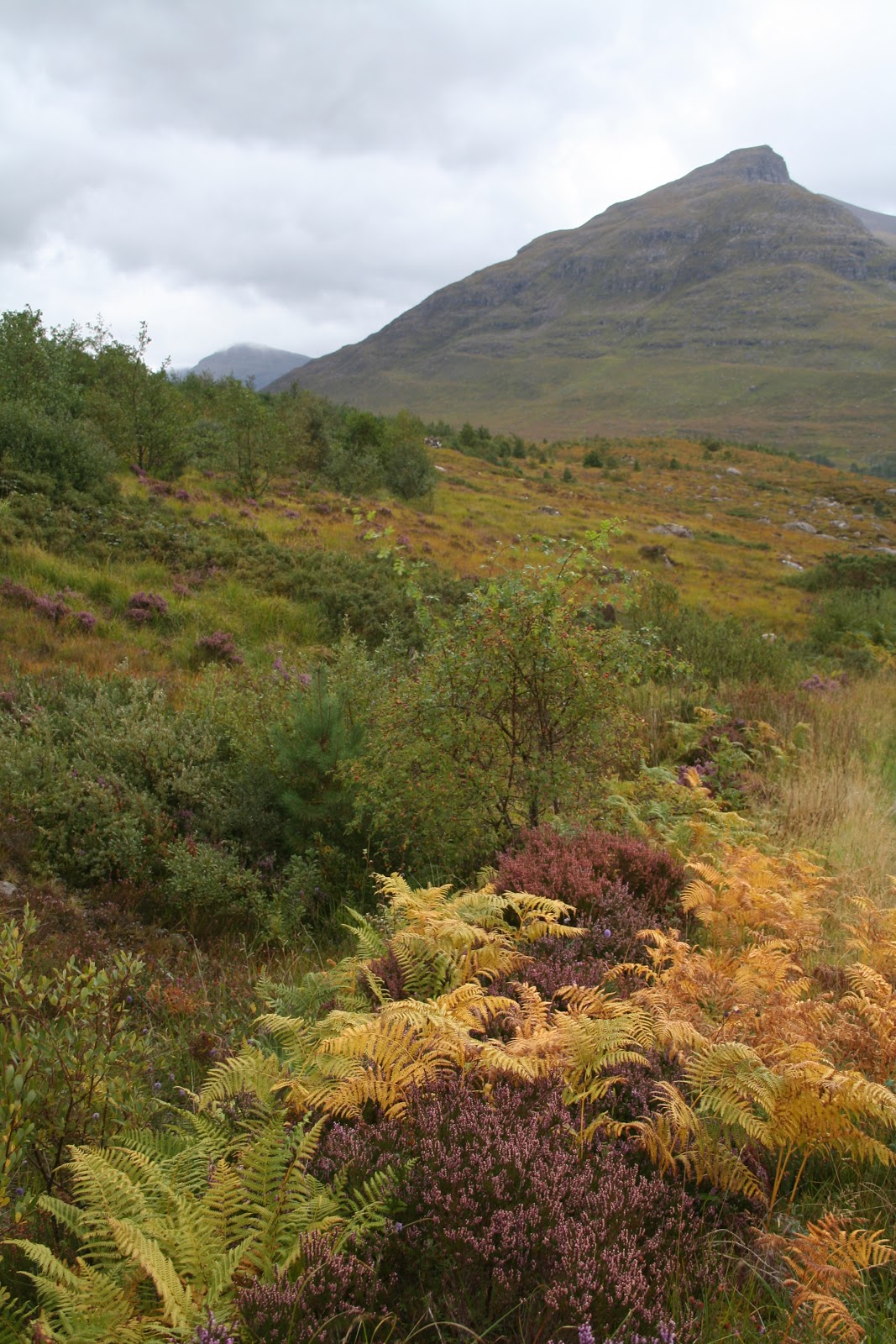
Glen Torridon had some great colours. All the bracken were turning from green to golden yellow and red. Purple heather were still amongst the landscape, creating such an array of colours. I would have loved to explore this area more, but given that my knee was talking to me a little from all the hiking I had been doing, and the fact that I didn't have any information an the trails beforehand, it was something I left for the future. So, just little walks around.
Saw a waterfall at the start of the Beinn Alligin trail. This would be a spectacular hike. I roamed just the beginning of the trail, and looking at the view of the valley beckoned to me "come and see." Sigh, yes, next time.
After, I met the two men at camp and we piled into my car and drove to the local bar/hotel for dinner. The food at the Torridon Inn was amazing! Glad it was too, considering it was the only place nearby to eat out. We enjoyed some good laughs and a couple drinks.
After packing up the next morning I had a leisurely drive back to Kinlochewe, enjoying the plants of the moorland. Being a higher elevation, the cooler damp climate allow the vegetation to grow. The acidic soils nourish these particular plants allowing extensive covering of the variety of plants. They have free draining ability, merging areas into bog land. In bogs, all the flooding prevents the oxygen from the atmosphere getting to the soil, causing the plants to decompose slowly creating peat. The peat is then dug by humans for use of fuel or gardening. So cool to think how everything is linked together.
I then stopped along Loch Maree. A very long lake with many picnic spots. Saw a sign for Victoria Falls, so of course I had to see it. Just a small little fall though.
Next, I arrived in Gairloch. After asking the visitor centre for a nice walk, I stopped at the golden sandy beach surrounded by dune grass near the golf course. Few people were there that day. Just walking their dogs mostly.
I was recommended to walk the Flowerdale waterfall trail. I passed a pony trekking centre, seeing all the horses grazing in the grass. Continued following a gravel pathway to a stream. I think, I saw the waterfall. I wouldn't have called it a waterfall as it was only 12 ft high really, but whatever. I walked the loop around to go up to a valley then come back down along the other side of the stream back to the car park. It wasn't very exciting, but at least I had a stretch.
I drove through Poolewe (which looked like a really nice area to camp), and took another break in Ullapool. Seeing how it was dinner time, most of the stores in this fishing village were closed but for the tourist shops. I popped into a little market to grab something for dinner, walked around the town, then drove to Knockan Crag.
By the time I arrived, it was late. Luckily, a sign said overnight parking was welcome at this little geological centre. The parking lot was empty so I found a nice protected spot and slept in the car. Nice to have bathroom facilities nearby.
This morning, after I had some fruit for breakfast, I walked to the display centre. There were computer screens and billboards with tons of information on the different kind of rocks, how they were made and shifted with the earth's plate movements.
The information was about Peach and Horne, two geologists who made leaps and bounds in discoveries to understand our planet. Some say their knowledge was as important as Charles Darwin's discoveries. The discoveries explained what happened when the earth collided and mountains formed. Explaining how older rocks were on top of newer rocks.
It was neat to learn that Scotland, once was near the south pole 600 million years ago. As it moved north, it had been underwater, then covered as a sandy desert, then erupting volcanoes and even a tropical rainforest. Eventually, it broke off from the American land mass to collide with European land mass to attach to England.
A walking path up the crag had info stops that explained what you were seeing in the rock formations and soil for plant growth. It was great. Even if you didn't have any previous knowledge of geology, you felt like a geology student on a field trip! Really well informed. I love geology, so of course I'd highly recommend this place.
Next pit stop was at Calda House and Ardvreck castle on Loch Assynt before branching off the main road and going to Stoer. Sometimes, even though a ruin is just another ruin, the setting is in such a lovely place, you can't help but take the time to appreciate the beauty of it.
Past Lochinver, I went to Clachtoll Beach. It had golden soft sand surrounded by tall dune grass and dark basalt rocks that protruded at an angle out of the sandy grains. Looked really neat. Highland cows were moseying along the beach as well, eating seaweed. A perfect place in the summer for swimming, sun bathing, camping and picnicking.
Stopping at the lighthouse, I parked my car and walked along the cliff edge to see the Old Man of Stoer. It was a lovely walk. Once I reached the 60 m sandstone pinnacle, I sat and watched the waves and Gannets flying over them. They were white with black tipped wings and had such beautiful yellow coloured heads. Gracefully gliding on the strong winds.
Once back in my car, I passed back though Lochinver. It sure had some lovely spots for photography with all the little tree covered islands on the lake.
Wasn't too long before I reached the small northern town, Durness. I pitched my tent at the Sango Sands Oasis Campsite. It was a big campsite. Lots of well kept grass on the ridge above the beach. Fantastic spot. They even had a bar and restaurant on the grounds. Perfect for a night cap!
Wester Ross is a beautiful area. Golden sandy beaches and purple heather moorland. I'm looking forward to seeing more of it tomorrow!